
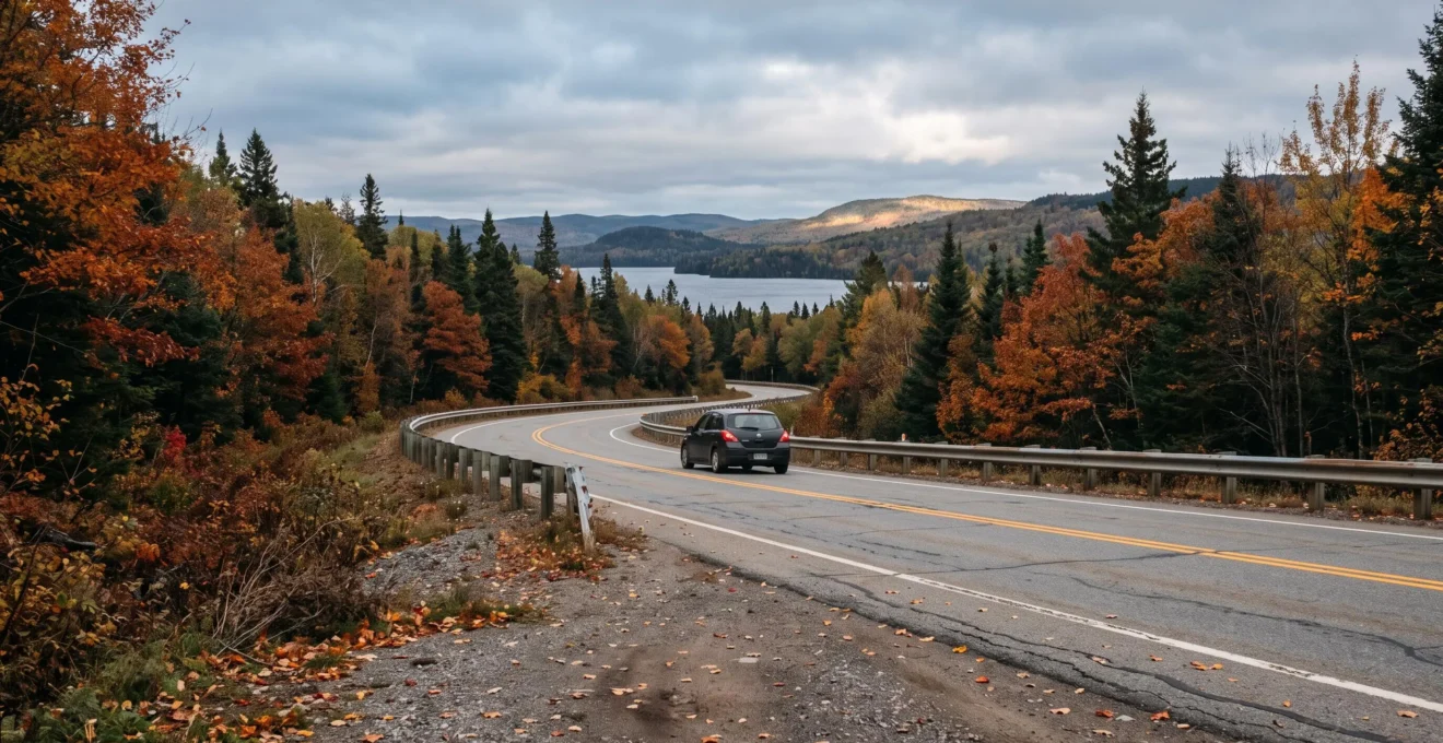
Three days off, $250 CAD for gas, and an eagerness to explore Canada’s most scenic landscapes: the challenge sounds simple enough. Yet a scenic route that looks breathtaking on a map can quickly become a stressful ordeal if it demands too much mileage, features remote accommodations, or exposes drivers to unpredictable weather.
The best road trip is not necessarily the most famous one: it is the itinerary that delivers rewarding scenery without exhausting drivers or blowing the budget. A regional loop through the Laurentians, Charlevoix, or the Eastern Townships is far more manageable from southern Quebec than attempting the entire Gaspé Peninsula loop. From the Maritimes, a section of the Cabot Trail offers an ideal getaway. In the West, the Icefields Parkway demands careful preparation, especially in autumn.
Your starting point changes everything. With a fixed fuel budget, the highway miles required to reach the scenic corridor must be accounted for just like the driving on site. Here is how to plan a three-day road trip that factors in seasonal weather, driver fatigue, vehicle choice, rest stops, and true operating costs.
Three Decisions for a Successful Scenic Road Trip
- Choose an accessible region: Pick an itinerary where round-trip mileage and local detours comfortably fit within a $250 CAD fuel budget.
- Match your route to the season: Check road reports, seasonal closures, tire regulations, and open roadside services before departing.
- Protect your leisure time: Limit total daily driving hours, schedule regular rest stops, and build in a time buffer for unexpected delays.
- Why an “incredible” route becomes hazardous in October when weather turns fast
- How to plan a 900 km road trip over 3 days without burning out behind the wheel
- Personal car, RV, or rental: Which choice keeps your total spend under $600 CAD?
- The classic scenic drive mistake: Leaving without offline maps or a fuel buffer
- When to hit the road to beat traffic, preserve daylight, and avoid overpriced lodging
- How to calculate your true daily driving costs without underestimating vehicle wear
- How to avoid running late 1 morning out of 3: A simple 4-step departure routine
- Why a spacious suburban chalet can cost $700 CAD/month more than staying central
Why an “incredible” route becomes hazardous in October when weather turns fast
In October, a Canadian scenic route can shift from crisp autumn conditions to slick, snow-covered asphalt in just a few kilometers. Higher elevations, shaded forest corridors, and rapid temperature swings can quickly complicate travel. The safest approach is selecting a route where road conditions can be verified in real time, reliable detour routes exist, and your vehicle is properly equipped.
The danger often stems from the contrast between the weather in your departure city and conditions at the highest elevation along your route. A valley may experience a light autumn drizzle while a mountain pass is hit with freezing rain or heavy snowfall. In dense forests, roads shaded from the sun stay wet, icy, and treacherous long after the rest of the highway has dried.
The Icefields Parkway (Highway 93 North between Lake Louise and Jasper) exemplifies this reality. According to Parks Canada information on the Icefields Parkway, this 232 km corridor can receive snowfall at any time of year, and conditions change abruptly. Commercial services are seasonal, and temporary closures are regularly enforced for avalanche control or severe weather.
To determine whether a route is safe and realistic in October, evaluate four core factors:
- Elevation profile: Identify mountain passes, steep grades, and high-altitude sections where freezing temperatures are common.
- Cellular connectivity: Pinpoint dead zones lacking dependable mobile reception.
- Seasonal facility closures: Confirm operating dates for gas stations, park visitor centers, and seasonal road gates.
- Tire requirements: Verify mandatory tire laws and traction device rules along your planned route.
In Quebec, mandatory winter tire requirements in Quebec apply from December 1 to March 15 for designated passenger vehicles. However, snow and black ice frequently appear well before December. Along the Icefields Parkway, winter tires or chains are legally required from November 1 to March 31, and whenever road surfaces are covered in snow or ice.
An unexpected road closure can also derail your budget. When a route is blocked and you are forced to turn back, your evening destination shifts and pre-booked accommodations may become unreachable. During peak fall-foliage weekends, securing an alternative hotel room at the last minute can be difficult and costly.
The safest approach is checking weather forecasts and provincial road reports 48 hours before departure, re-checking the night before, and reviewing cameras the morning you leave. Relying on provincial transit platforms—such as Quebec 511, Ontario 511, or Alberta 511—alongside highway webcams and official Environment Canada alerts provides real-time facts. A summer travel blog cannot substitute for up-to-date road condition reports.
A route that is slightly less dramatic but open, well-maintained, and close to essential services offers a far superior travel experience than an uncertain mountain pass. Once the corridor is validated, the next step is determining how many kilometers you can comfortably cover each day.
How to plan a 900 km road trip over 3 days without burning out behind the wheel
A 900 km road trip over three days averages out to 300 km per day, but that basic math does not guarantee a relaxing vacation. Along scenic corridors, sharp curves, viewpoint pull-offs, and lower speed limits significantly stretch driving times. To stay alert and safe, break the journey into short driving blocks, take frequent breaks, and aim to arrive well before sunset.
The most common mistake is confusing map distance with actual driving time. A route calculated by a GPS app does not account for scenic photo stops, full parking lots, seasonal slow-downs behind campers, or spontaneous village detours.
On routes like the Cabot Trail in Nova Scotia or Route 132 around the Gaspé Peninsula, the drive itself is the destination. Overlooks, coastal hamlets, and winding mountain grades warrant generous scheduling buffers. Adding a 30% to 50% time buffer over standard GPS estimates is a prudent planning guideline, even if conditions vary.
Here is a balanced pacing breakdown for a 900 km journey:
| Day | Planned Distance | Daily Objective |
|---|---|---|
| Day 1 | 250 km | Travel to the region, enjoy an initial scenic stop, and check in early. |
| Day 2 | 300 km | Drive the core scenic loop with multiple viewpoints and short hikes. |
| Day 3 | 350 km | Complete the return journey while maintaining a generous time buffer. |
This pacing is only workable if realistic driving speeds, road topography, and the number of drivers permit it. Covering 350 km on a winding, narrow coastal road can be far more fatiguing than driving 500 km on a divided multi-lane highway.
The Société de l’assurance automobile du Québec highlights, in its SAAQ recommendations on driver fatigue, the necessity of stopping for a break every two hours. According to provincial data from 2021 to 2025, fatigue was a contributing factor in 23 % of fatal crashes. This figure reflects Quebec collision statistics and serves as a powerful reminder of driving risks.
23%
Proportion of fatal road collisions in Quebec where driver fatigue was cited as a contributing factor between 2021 and 2025, based on SAAQ road safety reports.
Société de l’assurance automobile du Québec (SAAQ), Driver Fatigue, updated March 30, 2026.
A practical rule of thumb is driving in 90-to-120-minute segments, followed by deliberate rest stops in designated areas. Schedule the most challenging and winding stretches for the morning, when alertness is naturally highest after a good night’s rest.
For solo drivers, trimming total mileage is often the smartest compromise. Removing 200 km from a 900 km loop cuts out hours of continuous steering, unlocking extra time for leisurely meals, hiking, and recovery.
At the first sign of drowsiness, difficulty maintaining lane position, or wandering attention, pull over in a safe location. The SAAQ recommends taking a short 20-to-30-minute nap when fatigue sets in. If exhaustion persists, stay parked or find lodging for the night. Neither loud music nor coffee can replace restorative sleep.
A shorter geographic loop leaves more time to truly enjoy the landscape. Reducing distance also makes staying within your overall budget far easier, particularly when selecting your mode of transportation.
Personal car, RV, or rental: Which choice keeps your total spend under $600 CAD?
For a three-day getaway with a strict total budget cap of $600 CAD, driving your personal vehicle is generally the best starting point, provided it is mechanically sound. A rental car introduces fixed daily fees, while an RV may reduce hotel bills but significantly increases fuel consumption and campground costs. The smartest choice is based on total net costs, not headline rates.
Start by separating your two budget ceilings: $250 CAD allocated for fuel and $600 CAD for the entire trip. In this scenario, maxing out your fuel allowance leaves $350 CAD for all other expenses, including two nights of lodging, meals, park entrance permits, and incidentals.
The comparison below highlights the cost categories you must calculate before booking:
| Budget Category | Personal Vehicle | Recreational Vehicle (RV) | Rental Car |
|---|---|---|---|
| Fuel costs | Based on your vehicle’s real-world fuel economy. | Significantly higher due to weight, wind drag, and hills. | Varies by vehicle class and engine efficiency. |
| Fixed vehicle costs | No rental charge, but maintenance and wear apply. | Daily rental rate, mandatory insurance, prep fees. | Daily rental fees, optional waivers, security deposit. |
| Lodging expenses | Hotels, motels, B&Bs, or tent campsites. | Serviced RV sites or permitted dry camping spots. | Separate nightly lodging required. |
| Practical limitations | Vehicle reliability and cargo capacity. | Driving dimensions, parking limits, steep grade bans. | Mileage caps, fuel return policies, credit holds. |
Renting an RV can look appealing because it merges transportation and sleeping quarters. However, its larger size can complicate parking at tight scenic lookouts and make mountain driving cumbersome. You must also account for off-season campground closures and rental contract restrictions on certain roads.
To estimate your fuel expense, use this formula:
Fuel Cost = Total Distance (km) ÷ 100 × Actual Fuel Economy (L/100 km) × Average Gas Price ($CAD/L).
In a hypothetical 900 km scenario with a vehicle consuming 8 L/100 km and fuel priced at $1.70 CAD/L, gasoline will total $122.40 CAD. If driving a larger vehicle consuming 14 L/100 km at the same gas price, the fuel cost rises to $214.20 CAD. These figures are illustrative calculations rather than price forecasts.
On top of gas, factor in lodging, groceries, restaurants, park vehicle passes, and a 15% to 20% contingency fund for emergencies. If your $600 CAD ceiling is firm, this contingency reserve must be built inside that limit, not treated as an afterthought.
Certain scenic drives in Canada involve toll bridges or vehicle ferry crossings. If renting a vehicle, one-way drop-off fees can quickly destroy a budget. Ensure all rental quotes reflect your exact pick-up and drop-off dates, times, and branches.
For a couple with a reliable, fuel-efficient compact car, using their personal vehicle protects the largest portion of their travel budget. For a larger family, renting a larger vehicle may provide necessary comfort, but requires recalculating the fuel envelope to stay solvent.
The chosen vehicle must match the roads and available infrastructure along your route. Even a finely tuned budget falls apart if a closed rural gas station or an extended cellular dead zone catches you unprepared.
The classic scenic drive mistake: Leaving without offline maps or a fuel buffer
Along remote scenic highways, cellular coverage and open gas stations cannot be taken for granted. To prevent a simple navigational detour from turning into an emergency, download offline maps before leaving home, verify open fuel stops along your route, and maintain a healthy fuel reserve. Sharing your travel plan with an emergency contact completes this preparation.
Mountain passes, provincial and national parks, and extensive boreal forest corridors often have zero cellular reception. A fully charged smartphone remains a capable offline GPS navigator, but it cannot place an emergency call if you run out of fuel in a dead zone.
The Icefields Parkway provides a clear case study: Parks Canada warns that cellular service is virtually non-existent and commercial facilities are seasonal. The fuel station at Saskatchewan River Crossing operates only in the summer months. Throughout the winter, there are no roadside services or fuel stations open along the entire 232 km stretch between Lake Louise and Jasper.
Waiting for the low-fuel warning light to appear before looking for gas is dangerous in remote corridors. Adopt the golden rule of remote road-tripping: refuel whenever your tank drops below the half-way mark. This is a sound planning guideline, not an absolute guarantee against running dry.
It is equally important to distinguish between a gas station icon on a mapping app and a station that is open and pumping fuel. Rural businesses frequently shorten their off-season operating hours or carry limited fuel supplies. For drivers of diesel vehicles, verifying fuel availability in advance is especially critical.
Electric vehicle (EV) drivers must apply the same diligence to battery range and charging infrastructure. A charging station listed on an app may be offline, occupied, or incompatible with your vehicle’s charging standard. Check network status, connector types, payment apps, and identify backup level-2 or level-3 chargers along your route. Planning tools from charging networks and auto clubs like CAA are helpful, but direct route verification is essential.
Pre-Departure Safety Checklist: Five Verifications
- Download offline digital maps: Confirm maps open properly in airplane mode and save screenshots of your primary route.
- Map verified fuel stops: Mark operating gas stations and their confirmed hours on your daily route plan.
- Perform a pre-trip vehicle inspection: Inspect tire pressures, fluid levels, wipers, and pack an emergency kit with a flashlight, thermal blankets, water, and a portable power bank.
- Share your itinerary: Send your daily waypoints, booked accommodations, and estimated arrival windows to a trusted emergency contact.
- Identify an alternative detour route: Plot a secondary escape route in case your primary highway closes, noting the key decision junction.
Towing straps or emergency traction gear should only be deployed if they are fully compatible with your vehicle and you know how to use them safely. Attempting an improper roadside recovery in an isolated area can cause severe damage or injury.
Thorough preparation prevents urgent decision-making on the road. However, it must be paired with realistic daily schedules: a well-equipped car will not save you from navigating an unfamiliar, winding mountain highway in the dark.
When to hit the road to beat traffic, preserve daylight, and avoid overpriced lodging
To maximize a three-day scenic drive, an early morning departure offers far more flexibility than leaving late. Setting out early lets you clear urban congestion before rush hour, explore scenic viewpoints without crowds, and reach your evening accommodations before dark. The ideal departure time depends on your starting region, local traffic bottlenecks, and seasonal sunrise and sunset times.
On Friday afternoons, outbound highway traffic from major metropolitan centers can tie up traffic for hours. On Sunday, returning weekenders can cause similar congestion. In peak tourist seasons, parking lots at popular national park trailheads and viewpoints fill up early in the morning.
Daylight hours shrink rapidly throughout October. Sunset times vary substantially across Canadian latitudes and longitudes: do not apply a single sunset hour to the entire country. In eastern zones, twilight can arrive surprisingly early in the afternoon.
An effective strategy schedules your photography stops during optimal daylight hours, ensuring you finish winding, unlit rural roads well before nightfall. Scheduling a challenging mountain pass at dusk simply to catch evening light is a safety gamble.
Here is an illustrative daily schedule, easily tailored to your distance and season:
| Time of Day | Planned Activity |
|---|---|
| Early Morning | Pre-trip vehicle check, weather review, and departure. |
| Mid-Morning | Primary scenic viewpoint, short hike, or park attraction. |
| Midday | Lunch break, fuel check, and route pacing adjustment. |
| Early Afternoon | Secondary scenic drive segment or cultural stop. |
| Late Afternoon | Arrival at accommodations before sunset. |
Checking in early does not automatically guarantee a cheaper room rate; lodging prices are governed by supply, demand, and booking terms. However, booking your first night well in advance eliminates the stress of driving from hotel to hotel and having to pay premium walk-in rates when vacancy is scarce.
Keep check-in window policies in mind. Rural B&Bs and country inns often have strict evening check-in cut-offs, while provincial park campground gates may close early in the off-season. Building a daily one-to-two-hour buffer easily absorbs spontaneous roadside fruit-stand stops or scenic photo delays without throwing off your schedule.
A well-planned schedule creates freedom on the road rather than restricting it. Pacing also keeps your budget on track, especially when actual driving distances deviate from your initial map calculations.
How to calculate your true daily driving costs without underestimating vehicle wear
The true cost of a road trip goes well beyond the fuel pumped at the gas station. It includes a portion of routine maintenance, tire and brake wear, and trip-specific operating costs. To build an accurate travel estimate, calculate fuel consumption from your vehicle’s real-world efficiency, and add a per-kilometer maintenance allowance based on vehicle age and mileage.
The core distinction lies between your immediate out-of-pocket cash expenses and the broader economic cost of operating a vehicle. Gas and tolls represent immediate expenses. Depreciation, tire tread wear, brake pad reduction, and oil life degradation are not billed daily, but they represent real costs when comparing travel options.
You can calculate your operating cost in four straightforward steps:
- Calculate total planned kilometers for each day, including side excursions and detours.
- Measure or estimate your vehicle’s real-world fuel economy in L/100 km under road trip conditions.
- Multiply required liters by the regional retail fuel price factored into your budget.
- Add a per-kilometer maintenance allowance derived from your owner’s manual schedule and historic maintenance costs.
Natural Resources Canada’s guidance on fuel consumption ratings notes that standardized lab ratings allow consumers to compare vehicles, but do not capture real-world conditions. Driving speed, heavy cargo, cold weather, mountain climbs, and tire condition all increase fuel consumption.
Consider a hypothetical daily drive of 80 km in a car consuming 8 L/100 km, with fuel budgeted at $1.70 CAD/L. The drive consumes 6.4 liters of fuel, costing $10.88 CAD. If the owner estimates a maintenance and wear allowance of $0.08 CAD/km, that adds $6.40 CAD to the ledger.
Case Study: The Calculated Operating Cost of 80 Kilometers
For a vehicle averaging 8 L/100 km with gasoline at $1.70 CAD/L and an estimated wear allowance of $0.08 CAD/km, driving 80 km incurs $10.88 CAD in fuel and $6.40 CAD in vehicle wear.
The illustrative total is $17.28 CAD for the day, excluding accommodations, meals, parking permits, tolls, and fixed ownership costs like annual insurance. The fuel and wear numbers in this example are planning benchmarks rather than official statutory rates.
Your maintenance allowance should reflect your vehicle’s reality. Your owner’s manual outlines routine service intervals, while past maintenance receipts provide baseline costs. You can calculate an average cost per 10,000 km and apply that rate across your trip distance. Premium tires, specialized brake components, or older vehicles with higher repair frequencies will shift this number.
For electric vehicles, the methodology is identical, substituting kilowatt-hours (kWh) for liters of fuel. Calculate consumption in kWh/100 km, factor in charging losses, and check commercial charging rates. In October, cold ambient temperatures will reduce battery range, especially when cabin heating is running continuously.
Knowing your true cost per kilometer also helps evaluate accommodations: it reveals whether choosing an out-of-the-way rural lodge truly saves money once you tally up the extra driving required. Just be careful not to confuse full economic cost with the immediate cash needed in your wallet during the three days.
A reliable financial estimate must be paired with an achievable daily routine. Without a disciplined morning departure, early delays can wipe out planned savings before lunchtime.
How to avoid running late 1 morning out of 3: A simple 4-step departure routine
To prevent travel delays on a three-day road trip, the best strategy is preparing the next day’s departure the night before. Four basic steps are all it takes: check weather and road updates, prep the vehicle, set two firm daily time benchmarks, and build in a departure buffer. This routine eliminates morning confusion without feeling rigid.
A delay in the morning sets off a domino effect across your entire day. Leaving an hour late pushes back your scenic stops, delays lunch, and forces an arrival after dark. When drivers rush to make up lost time on winding roads, fatigue and stress increase exponentially.
This four-step evening routine keeps travel smooth:
- Check road conditions the night before: Review weather reports, highway cameras, and official closure notices. Decide if your planned route remains safe.
- Prep the vehicle in the evening: Check fuel levels, inspect tire pressures, ensure emergency gear is accessible, and pack bags so the driver’s rear visibility remains clear.
- Establish two daily time benchmarks: Pick a target arrival time for your main scenic stop and a firm arrival time for your evening lodging, accounting for meals and rest stops.
- Add a departure time cushion: Allocate 30 to 45 minutes for breakfast, loading the car, and unexpected delays rather than timing departure down to the minute.
The reference to running late “1 morning out of 3” illustrates a common travel pitfall rather than an academic statistic. The objective of the routine is making your road trip resilient against predictable delays.
Your wallet also benefits from a disciplined routine. When schedules unravel, travelers are more likely to make hasty decisions: paying for emergency lodging, eating expensive convenience meals, or making rushed detours. Protecting your schedule keeps your options open.
Pay close attention to your final day. Your return time must balance total driving hours, required rest stops, rush-hour traffic approaching the city, and setting sun. If your schedule forces hours of nighttime driving on rural highways when you are already tired, adjust your route.
Dropping an optional secondary viewpoint is always better than sacrificing sleep or speeding to meet a rigid tourist itinerary. The best viewpoints are the ones you can enjoy without watching the clock.
With your daily driving schedule dialed in, the final decision is where to spend the night. An accommodation that appears cheap online can quickly lose its appeal if reaching it requires hours of driving out of your way.
Key Considerations When Booking Road Trip Lodging
- Compare the total net cost of the stay, not just the advertised room rate per night.
- Factor in the cost of round-trip detours, extra restaurant meals, parking fees, and cleaning charges.
- Choose lodging locations that keep you on schedule and protect your $250 CAD fuel budget.
Why a spacious suburban chalet can cost $700 CAD/month more than staying central
A spacious suburban rental can cost more than a centrally located room when detours, extra fuel, restaurant meals, and platform fees exceed the savings on the nightly rate. For a three-day road trip, you must evaluate costs over two nights rather than extrapolating a monthly $700 CAD figure. That monthly number serves as an illustrative economic comparison, not a proven expense for a weekend getaway.
Travelers often fall into this trap when choosing between an inexpensive, secluded country chalet and a moderately priced motel along the main scenic highway. The chalet may advertise a lower nightly rate, but requires an extra hour of driving each way to reach attractions, restaurants, and grocery stores.
Here is the formula for calculating true lodging costs:
True Lodging Cost = Nightly Room Rates + Booking & Cleaning Fees + Detour Driving Costs + Incidental Dining Expenses.
Consider a hypothetical comparison: a secluded chalet costs $220 CAD for two nights, while a central hotel along the main highway costs $280 CAD. On paper, the chalet appears to save $60 CAD.
However, reaching the chalet adds 100 km of round-trip detours. Factoring in $20 CAD in fuel and vehicle wear ($0.20 CAD/km), $55 CAD in platform cleaning and service fees, and $30 CAD in extra dining expenses because the kitchen was too far away for lunch, the chalet totals $325 CAD. The central hotel remains at $280 CAD.
| Expense Category | Secluded Rural Chalet | Central Highway Hotel |
|---|---|---|
| Two nights lodging | $220 CAD | $280 CAD |
| Detour driving cost (100 km) | $20 CAD | $0 CAD |
| Cleaning & service fees | $55 CAD | $0 CAD |
| Incidental meals due to location | $30 CAD | $0 CAD |
| Illustrative Total Spend | $325 CAD | $280 CAD |
In this scenario, the chalet ends up costing $45 CAD more despite its lower base rate. These figures illustrate the methodology; they are not set market averages for Canadian travel.
The figure of $700 CAD per month applies to residential commuting economics and daily vehicle ownership, rather than a short three-day vacation. It should not be cited as the typical outcome of renting a vacation cottage. For a three-day trip, base your calculations on your exact travel dates and confirmed costs.
In October, peak fall foliage and the Canadian Thanksgiving holiday can tighten lodging availability in popular regions. Room rates fluctuate significantly based on booking lead times and cancellation policies. Ensure you compare options with identical cancellation terms and guest capacities.
A secluded cottage can still be the superior choice if you prepare all meals in its kitchen, stay multiple nights to eliminate daily packing, or travel with a family that needs separate bedrooms. Extra space and comfort provide real value, provided the additional driving is accounted for.
To finalize your decision, compare the total net cost alongside the extra driving time required. If booking the cheaper chalet forces you to drive an extra hour along unlit, winding secondary roads each night, that trade-off must be weighed carefully against the savings.
To choose your ideal scenic road trip, start by mapping a regional loop that begins right at your front door. Calculate your total fuel needs, check seasonal highway conditions, set realistic daily driving stages, and compare lodging on a total-cost basis. If your planned loop exceeds your $250 CAD fuel budget or demands exhausting driving hours, shrink the travel radius rather than cutting corners on rest or safety.
Can you drive 900 km in three days on a $250 CAD gas budget?
Yes, it is achievable in fuel-efficient vehicles under favorable fuel pricing, but it is not guaranteed. For example, driving 900 km at an average fuel economy of 8 L/100 km requires 72 liters of fuel. At an illustrative price of $1.70 CAD/L, fuel costs $122.40 CAD. Driving an SUV or truck with higher consumption will cost significantly more. You must also factor in side trips, vehicle cargo weight, and terrain.
Which scenic route in Canada is best for a first-time three-day road trip?
The best route depends directly on your departure city. From southern Quebec, a regional loop through the Laurentians, Charlevoix, or the Eastern Townships minimizes transit mileage. From the Maritimes, driving a section of the Cabot Trail is an exceptional short trip. In Western Canada, parts of the Canadian Rockies are accessible, though seasonal facility closures and alpine weather must be verified. No single corridor can be crowned the cheapest without factoring in your starting location and vehicle.
Is it safe to drive mountain passes in October with all-season tires?
It depends on the province, specific highway regulations, tire markings (M+S vs. 3-Peak Mountain Snowflake), and active weather. In Quebec, mandatory winter tire rules take effect on December 1, though snow can fall much earlier. Certain high-elevation mountain routes, including the Icefields Parkway, mandate winter tires or chains starting November 1 or whenever snow or ice is on the road. Check regional regulations and road conditions before leaving. If snow or black ice is forecast, postponing the trip is far safer than driving with inadequate tires.
How many scenic viewpoints can you realistically visit in a day?
There is no fixed number, but on heavy driving days, it is best to prioritize one major attraction and two or three optional secondary stops. Walking distances from parking areas, viewpoint accessibility, parking availability, and daylight hours dictate feasibility. Less critical stops should be easily skippable so you can protect your arrival time and prevent driver fatigue.
What should you do if a scenic highway closes during your trip?
Respect all closure signs, check official provincial highway platforms (such as 511 services), and follow a verified detour route. If no safe detour exists, shorten your itinerary or hold in place until the road reopens. Notify your accommodation and emergency contact immediately. Never bypass road closure gates or attempt unmaintained forestry roads as improvised shortcuts.