
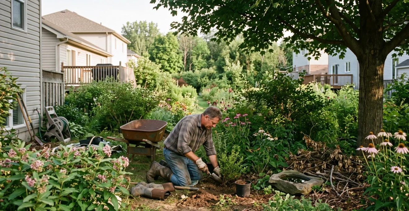
A forest borders your cottage, mature trees line your property, and neighboring fields look as green as ever. Yet birdsong is noticeably quieter, certain butterflies have become rare, and insects seem far less abundant. This decline is not an illusion: a landscape can retain its lush green appearance while steadily losing its biodiversity.
Across Canada, environmental pressures on wildlife do not stop at municipal boundaries. Secondary roads, artificial night lighting, habitat fragmentation, intensive lawn care practices, and changing climate patterns alter species survival conditions—often without visible, dramatic changes to the physical landscape.
Property owners can take practical action. Preserving a natural hedgerow, replacing mowed turf with native plants, controlling invasive alien species, or protecting a riparian buffer are accessible land stewardship practices. Their impact depends on the lot, adjacent ecosystems, and local wildlife species. The goal is not turning every backyard into untouched wilderness, but restoring tangible ecological functions to your land.
Local Biodiversity: Three Decisions That Matter
- A green space is not automatically a high-quality habitat: ecological fragmentation and artificial disturbances matter just as much as vegetated square footage.
- Preserving native plants, cutting chemical treatments, and connecting with adjacent natural patches improves forage and shelter for wildlife.
- Before landscaping, screen for invasive species, check regional bird nesting periods, and evaluate property-specific climate risks.
- Why biodiversity can collapse near your home without a single new house being built
- How to transform your yard into a “living corridor” in 4 steps without working every weekend
- Lawn vs. native plants: Which option reduces maintenance and genuinely supports pollinators?
- The mistake degrading local habitats: Planting an attractive invasive species and losing control
- When to plant and when to leave things “messy” for wildlife: A simple seasonal calendar
- Heat pump or electric vehicle: Which investment cuts your carbon footprint more in Quebec?
- How to evaluate your property vulnerability in 60 minutes using 3 credible sources
- Why your flood risk can change without you ever moving
Why biodiversity can collapse near your home without a single new house being built
Biodiversity can decline without new construction because the ecological quality of existing habitats deteriorates incrementally over time. An existing roadway, brighter outdoor lighting, chemical pesticide treatments, or the removal of understory shrubs can disrupt wildlife life cycles. The land stays green on the surface, but feeds, shelters, and connects fewer species.
A functional habitat cannot be evaluated by surface area alone. A woodlot bisected by a paved road may keep nearly all of its canopy, yet become inhospitable for sensitive wildlife. Traffic noise, headlights, and canopy breaks fundamentally alter microclimates along the road: these are known as edge effects.
Fences can also block movement corridors for terrestrial mammals, reptiles, and amphibians. Conversely, a continuous native hedgerow or vegetated buffer strip provides a safe corridor for wildlife adapted to brush cover. The net ecological benefit depends on property layout and local wildlife populations.
Other environmental pressures are largely invisible. Artificial night lighting disrupts nocturnal pollinators and migratory birds; lawn pesticides impact non-target soil organisms; and outdoor domestic cats exert sustained predatory pressure on songbirds and small mammals. Persistent acoustic disturbance and human activity also discourage birds from nesting.
However, it is misleading to attribute every local wildlife decline to a single factor. Multiple environmental pressures act concurrently, and their severity varies from one ecosystem to another.
−67%
Net change in Canadian grassland bird populations between 1970 and 2022. This represents an aggregate national indicator for an ecological group, rather than a direct biodiversity measurement for an individual lot.
Federal indicator on Canadian bird population trends.
Federal wildlife indicators also document a decline in aerial insectivore populations of 43 % between 1970 and 2022. These findings do not mean every bird species is declining: across 331 analyzed bird species, 139 showed population decreases, 104 showed increases, and 88 remained stable or showed little change.
This distinction matters. The decline of a common species often goes unnoticed because individual sightings still occur. Yet sustained population losses undermine the interdependent relationships between native plants, insects, birds, and other organisms.
To assess your property, audit recent physical changes: cleared understory shrubs, new exterior floodlights, manicured lawns replacing natural groundcover, new perimeter fencing, or synthetic chemical applications. Track these observations across multiple seasons rather than drawing conclusions from a single afternoon.
The next step is using this assessment to restore ecological connectivity across your property, without needing to re-wild your entire lot overnight.
How to transform your yard into a “living corridor” in 4 steps without working every weekend
To create a functional living corridor, identify adjacent natural habitats, preserve valuable established vegetation, plant diverse native species, and link fragmented garden beds. Four progressive steps are all it takes to establish wildlife connectivity. The ecological return depends on canopy continuity, available food and water resources, and the wildlife species active in your area.
The core concept is simple: wildlife does not recognize property lines. A hedgerow, a mature oak, a patch of native perennials, or a wooded drainage swale provides stepping-stone habitat. However, a fragmented string of manicured backyards does not automatically form a functional wildlife corridor for every species.
Step 1 — Map existing ecological connections. Look beyond your property lines. Does a row of neighboring shrubs connect to a nearby woodlot? Does a stream buffer cross several properties? Are there pollen-rich gardens on adjacent lots? Sketch these features on a basic yard map.
Step 2 — Protect before you plant. Preserve established native trees, healthy understory shrubs, and naturalized vegetation already on the property. Preserving existing, mature habitat is far more effective than clearing the ground and trying to recreate it with nursery saplings.
Step 3 — Diversify structural layers. Combine canopy trees, understory shrubs, native grasses, and perennials that offer staggered blooming periods from spring to frost. Retain leaf litter and standing perennial stems over winter. A shallow bird bath or rocky water dish provides essential hydration if refreshed regularly to prevent mosquito breeding.
Step 4 — Coordinate with neighbors. Encourage adjacent property owners to connect planting beds along shared fence lines to create a continuous vegetation strip. Community associations or local school programs can also participate. While wildlife habitat certifications provide structure, they cannot substitute for tracking actual on-the-ground ecological use.
Parks Canada recommends planting native wildflowers and emphasizes that even container plantings on urban balconies provide valuable forage for pollinators, as outlined in Parks Canada guidance on planting for pollinators.
On small urban lots, flowering planter boxes provide nectar and pollen, but cannot replicate the ecological value of deep soils, mature tree canopies, or ground-level wildlife cover. Green roofs similarly offer distinct opportunities and structural constraints.
If maintenance time is limited, focus on two or three high-impact actions: preserve a continuous native shrub layer, eliminate unnecessary pesticides, and add diverse native perennials. You can expand plantings over time as you see which species establish successfully.
Corridor continuity is vital, but plant composition is equally important. Choosing between conventional turfgrass and native groundcovers requires evaluating real-world maintenance requirements.
Lawn vs. native plants: Which option reduces maintenance and genuinely supports pollinators?
A conventional turfgrass lawn provides virtually no forage for pollinators when mowed frequently. Well-chosen native plants support local ecosystems far better, but do not always require less work, particularly during their initial establishment years. The most practical approach is often keeping a modest mowed zone for daily recreation while gradually converting underutilized lawn into native plantings.
The difference goes beyond curb appeal. For native bees and butterflies, flower abundance, nectar quality, seasonal timing, and species compatibility dictate whether a garden supports their life cycle. A colorful mass of non-native ornamental annuals cannot replace the evolutionary relationships of a native plant community.
The comparative matrix below outlines real-world trade-offs across three common landscaping approaches. Maintenance requirements depend on soil type, seasonal moisture, and species selection.
| Evaluation Criterion | Conventional Turfgrass | Native Meadow / Groundcover | Native Perennial Beds |
|---|---|---|---|
| Mowing requirements | Regular weekly or bi-weekly mowing | Low (annual late-winter or spring cut) | No mowing required |
| Watering needs | High during dry summer spells | Critical during establishment; low once rooted | Low once native root systems mature |
| Initial labor | Lawn seeding, sodding, and grading | Weed eradication and careful establishment | Mulching, planting, and hand weeding |
| Pollinator forage | Extremely low; flowers mowed down | Diverse seasonal nectar and pollen sources | Curated continuous blooms spring to fall |
| Daily foot traffic | Resilient to play, pets, and recreation | Sensitive to regular foot traffic | Best suited for garden perimeters |
In Canada, alternatives to manicured lawns include shade-tolerant native groundcovers, shortgrass prairie mixtures, or structured perennial borders. Always check sunlight, soil drainage, and native ecozone ranges before planting. A species native to coastal British Columbia is not necessarily native or hardy in southern Ontario or Quebec.
Milkweed provides a classic example of plant-insect co-evolution: monarch butterfly caterpillars feed exclusively on milkweed foliage. This biological dependency shows why non-native ornamental flowers cannot support specialist insects that rely on specific native host plants.
Seasonal bloom timing is equally critical. A garden that blooms only in midsummer leaves pollinators without food during critical spring emergence and autumn hibernation preparation.
A staged conversion prevents overwhelm. Start with a sunny, low-traffic corner of your lawn, monitor its growth over two full growing seasons, and expand your native beds once you understand how the plants establish in your soil.
Be sure to consult local municipal property standards bylaws regarding maximum vegetation height. A naturalized planting bed bordered by clean stone edging or a mowed turf strip signals intentional design, helping satisfy municipal bylaws while preventing neighbor complaints.
Plant selection must look beyond aesthetics and nursery availability: introducing an unverified plant can unleash an invasive species that damages surrounding natural areas.
The mistake degrading local habitats: Planting an attractive invasive species and losing control
An ornamental garden plant becomes an ecological threat when it escapes domestic cultivation, invades adjacent ravines and natural ecosystems, and outcompetes local flora. Not all non-native plants are invasive, but those with aggressive growth traits disrupt ecosystems. The single best way to prevent ecological damage is verifying botanical Latin names and regional invasive status before buying.
Invasive plants spread aggressively through windblown seeds, extensive rhizomes, or fragmented root systems. Once established in natural areas, controlling them requires years of manual labor or chemical treatment. Invasive plants crowd out native seedlings, alter soil chemistry, and reduce biodiversity.
Across Canada, common buckthorn and invasive Phragmites (European common reed) have transformed vast ecosystems. Giant hogweed represents an additional public health hazard due to its phototoxic sap, which causes severe skin burns. Control protocols must be assessed species by species.
The Government of Quebec warns that invasive alien species are difficult and expensive to eradicate. In Quebec, a provincial regulation enacted on June 4, 2026, strictly prohibits the commercial sale and propagation of 31 designated invasive plant species, as outlined on the Government of Quebec webpage on invasive alien species.
This statutory ban does not mean every non-native ornamental plant is illegal, nor do identical regulations apply across all Canadian provinces.
Pre-Purchase Invasive Species Screening: Five Actions
- Confirm the full botanical Latin name on the plant tag or ask nursery staff. Deliverable: a verified botanical species record.
- Check provincial invasive species council databases and government prohibited plant lists. Deliverable: a documented check of provincial status.
- Match the plant’s growth characteristics against your yard’s soil, drainage, and light conditions. Deliverable: a basic site suitability assessment.
- Identify adjacent natural areas vulnerable to seed dispersal (ravines, woodlots, waterways). Deliverable: a sketch of neighboring natural areas.
- Select a certified native alternative or decline the purchase if invasive risks are identified. Deliverable: an environmentally sound plant choice.
On an established property, watch for warning signs: seedlings popping up far from the original garden bed, aggressive root suckering, or a single plant monoculture dominating your borders. These signs warrant immediate botanical identification.
Early control measures include cutting seed heads before they mature, bagging plant material for municipal waste disposal rather than home composting, and targeted manual removal. Never dump garden clippings into adjacent forests or ravines. Hand-pulling is not universally recommended, particularly for plants like giant hogweed that require specialized protective equipment.
Invasive plant spread impacts neighboring private lands and public conservation areas. Property owners carry an ethical responsibility to prevent escapes, even where municipal bylaws do not mandate removal.
Once you select safe plant species, maintenance timing must respect natural wildlife cycles: an aggressive spring garden cleanup can easily wipe out the beneficial insects you set out to support.
When to plant and when to leave things “messy” for wildlife: A simple seasonal calendar
The optimal window for planting or pruning depends on your local climate, soil moisture, and wildlife activity. In Quebec and eastern Canada, spring and early autumn are prime planting windows, while tree pruning and major brush clearance must avoid active bird nesting periods. Leaving fallen leaves and hollow plant stems over winter protects vital micro-habitats.
The seasonal calendar below serves as a practical guide for southern Quebec and eastern Canadian gardens. It is not an across-the-board rule for all of Canada: seasonal timing varies considerably across southern Ontario, the Prairies, the Pacific coast, and northern regions.
| Season | Recommended Activity | Key Ecological Precaution |
|---|---|---|
| Late Winter | Plan native plantings and inventory mature trees | Leave standing stems and mulch undisturbed |
| Spring | Plant native perennials and shrubs once soil warms | Delay cutting back old stalks and leaf mulch |
| Late Spring / Summer | Monitor plantings, manage invasives, and deep-water | Avoid heavy pruning during peak bird nesting season |
| Autumn | Plant shrubs and trees; leave fallen leaf litter | Avoid cutting down hollow stems; leave flower seeds |
| Winter | Observe wildlife habitat structures and track footprints | Minimize disruption to snow-covered shelter zones |
Fallen leaves provide an insulating blanket that protects soil ecology and shelters overwintering caterpillars, beetles, and queen bumblebees. Standing hollow stems of native perennials serve as winter nesting cavities for solitary native bees. However, structural value depends on stem diameter and local insect populations; not every hollow stem is occupied.
Spring garden cleanup should be phased gradually rather than completed on the first warm April weekend. Keep naturalized shelter corners intact until nighttime temperatures consistently rise above 10°C, ensuring beneficial insects have emerged from dormancy.
Nesting birds require special protection. The federal Migratory Birds Regulations, 2022 protect active nests containing viable eggs or live birds across Canada. Certain designated species receive year-round nest protections. Regional nesting seasons fluctuate based on latitude, spring temperatures, and species.
Before pruning large hedges or trees in spring or early summer, look for parent birds carrying nesting materials or food. The absence of a visible nest does not guarantee branches are empty. If bird activity is evident, postpone pruning until fledglings have departed.
It is important to differentiate intentional ecological structure from property neglect. A layer of whole leaves under a shrub border, a tidy brush pile for small mammals, and standing wildflower seed heads provide habitat. Uncontrolled weeds spreading onto adjacent sidewalks, unmanaged invasive plants, or accumulations of rotting garbage require active management.
Municipal property bylaws often mandate trimmed turf along street curbs and property lines. Maintaining a mowed perimeter around a naturalized garden bed frames the habitat neatly, demonstrating that the space is intentionally cared for.
These habitat choices support local biodiversity in your backyard. On a broader scale, reducing household energy consumption helps ease the climate pressures transforming ecosystems across the country.
Heat pump or electric vehicle: Which investment cuts your carbon footprint more in Quebec?
In Quebec, your largest carbon reduction depends primarily on the fossil fuel you are replacing. Installing a cold-climate heat pump delivers dramatic emissions cuts if it replaces an oil-fired furnace. Switching to an electric vehicle offers significant reductions for a household driving high annual mileage in a gasoline-powered car. Neither choice is universally superior for every family.
Quebec’s electricity is generated almost entirely by low-carbon hydroelectric facilities. This clean power makes electrifying heating and transportation an effective way to displace fossil fuels. However, you must evaluate your starting baseline before investing.
A home that already heats with electric baseboards has minimal direct fossil emissions to eliminate. While a heat pump will reduce total electricity consumption and add air conditioning, its net carbon reduction is small compared to replacing an oil-burning furnace.
Similarly, an EV driven 25,000 km per year eliminates substantial tailpipe emissions. If your car is driven only 5,000 km annually, the net carbon savings will be far more modest, particularly when accounting for embodied emissions from battery manufacturing.
| Current Baseline Situation | Heat Pump Investment | Electric Vehicle Investment |
|---|---|---|
| Oil-fired home heating | High carbon reduction by displacing fuel oil | Depends on annual vehicle mileage |
| Electric resistance baseboards | Improves efficiency; minimal carbon cuts | Higher carbon impact if driving mileage is high |
| High-mileage gasoline vehicle | Secondary to replacing fossil heating | High carbon reduction by displacing gasoline |
| Poorly insulated building envelope | Insulate before sizing mechanical equipment | Independent of home thermal envelope |
To prioritize, calculate your annual heating fuel and vehicle gasoline consumption. Compare projected savings using Quebec grid emissions factors, while factoring in embodied equipment manufacturing footprints. Claiming that one solution is always superior without reviewing household data is misleading.
Electrical service capacity must also be verified. Adding a central heat pump and an EV Level 2 charger increases household electrical load. Have an electrician confirm your panel capacity and review Hydro-Québec and government incentive programs before committing to equipment purchases.
The link to biodiversity is indirect but meaningful: climate change alters regional temperatures, seasonal precipitation, and plant bloom schedules that native wildlife depends upon. Lowering household carbon emissions helps mitigate global climate disruption; stewarding local habitats supports biodiversity right at home.
Household decarbonization should be paired with an assessment of the climate risks directly facing your physical property.
How to evaluate your property vulnerability in 60 minutes using 3 credible sources
You can complete a preliminary climate vulnerability assessment in 60 minutes by combining three sources: official municipal risk maps, federal climate projections, and a physical inspection of your lot. The goal is not producing a formal engineering audit, but identifying primary hazard exposures, vulnerable building components, and priority mitigation steps.
Risk is not defined by hazard alone. Two neighboring properties in the same watershed can experience completely different flood damage depending on lot grading, basement construction, weeping tile integrity, and emergency preparedness.
Structure your assessment around three core dimensions:
- Exposure: Is the property located within a mapped flood zone, coastal storm surge zone, wildfire interface, or urban heat island?
- Sensitivity: Does the home have features that increase damage severity, such as a finished basement, ground-level window wells, or a private well?
- Adaptive Capacity: What practical defenses are in place, such as a backup battery sump pump, naturalized swales, or active community support?
Spend the first 20 minutes reviewing provincial and municipal flood and hazard maps. Look up designated flood zones, slope instability areas, and wildfire interface maps. Record the publication dates and technical limits of each map.
Dedicate the next 20 minutes to exploring Canadian public climate data portals, such as the Canadian Centre for Climate Services. These resources provide regional climate projections, extreme rainfall return periods, and temperature trends. Regional projections illustrate broad climate trends rather than predicting exact events at your street address.
Spend the final 20 minutes inspecting your yard. Look at ground slopes, surface water pooling, downspout discharge locations, ditch conditions, foundation wall cracks, mature tree stability, and areas where soil dries out completely.
Hypothetical Case Study: A Property Near a Creek
A homeowner notes that their lawn slopes toward a small creek. Roof downspouts discharge directly toward the slope, and water pools along the foundation wall after heavy rainfall.
This does not prove the home sits in an official flood plain. However, it indicates a need to check municipal flood maps, extend downspouts away from the foundation, and restore native riparian vegetation along the creek bank, subject to local environmental regulations.
Data loses reliability when publication dates are missing, mapping methodologies are undocumented, or automated real estate tools present generic hazard estimates as formal site assessments. Verify data sources before financing major structural retrofits.
At the end of your 60-minute review, triage your findings into three categories: obvious issues you can fix yourself, risks needing municipal verification, and complex structural concerns requiring a professional engineer.
A drought-prone lot calls for deep-rooting native plants and organic mulching to protect the soil. A property near a creek requires attention to drainage swales, riparian buffers, and shoreline regulations. The right strategy responds to the specific hazard identified.
This assessment provides a baseline for tracking changes: a property’s flood vulnerability can shift over time even when you have never moved.
Key Considerations When Evaluating Flood Risks
- A static, familiar view out your window does not mean your property’s flood exposure has remained unchanged.
- Wetlands and riparian shoreline buffers must be protected as natural flood barriers, rather than treated as surplus development land.
- Decisions regarding landscaping, insurance, or property sales must be based on updated municipal mapping and governing environmental bylaws.
Why your flood risk can change without you ever moving
A home’s flood risk can rise or fall without you moving if regional rainfall intensity, watershed drainage, or upstream land development patterns shift. Upstream paving, the loss of natural wetlands, and changing weather systems alter local hydrology. An updated municipal flood study can also reveal a hazard that existed previously but was undocumented.
Three primary mechanisms drive changes in flood risk:
The first is extreme rainfall. Climate change increases the frequency and volume of short-duration, high-intensity cloudburst events in several Canadian regions. Surface water runoff can quickly overwhelm municipal storm sewers, causing overland urban flooding regardless of river proximity.
The second is watershed development. When upstream meadows, forests, or agricultural lands are paved for subdivisions or commercial centers, rainwater can no longer infiltrate the soil naturally. Runoff rushes into local storm sewers, creeks, and ditches, increasing downstream flood peaks and eroding streambanks.
The third is technical mapping updates: municipal and provincial flood plain maps are updated as new LIDAR elevation data, updated rainfall statistics, and advanced hydraulic models become available. A property added to an updated flood zone has not necessarily changed physically, but its documented risk profile has been refined.
Natural wetlands play an essential protective role. Acting as natural sponges, wetlands absorb heavy rainfall, store runoff, and release water slowly into local streams. Vegetated riparian buffers along waterways stabilize shoreline soil, reduce erosion, and slow flood velocities.
However, natural buffers have operational limits: planting shrubs on a single lot will not protect a house against a major river flood. Flood risk mitigation depends on watershed-scale hydrology that extends far beyond individual property boundaries.
For a homeowner, preserving existing riparian vegetation, avoiding unpermitted fill in floodways, and restoring natural drainage swales deliver both ecological and flood-resilience benefits. However, construction or soil disturbance along shorelines or within flood zones is strictly governed by municipal and provincial conservation authorities.
Re-evaluate your property risk when your municipality releases updated flood studies, when major commercial developments break ground upstream, or when you notice new surface runoff patterns. Save dated copies of consulted hazard maps to distinguish newly documented risks from physical changes on the ground.
Changes in mapped flood risk directly affect home insurance availability, overland flood water endorsements, municipal permit conditions, and mandatory real estate disclosure obligations. These terms vary by province, insurance underwriter, and property location. Confirm policy details directly with your insurer rather than making assumptions based on historical maps.
Start by consulting your municipality’s current flood and hazard maps, then identify a concrete stewardship project for your yard: protect a naturalized garden patch, redirect downspout drainage safely away from foundations, or schedule a professional engineering review if needed. Biodiversity conservation then becomes an integral component of practical land stewardship, rather than an isolated gardening chore.
Can a small residential yard genuinely help biodiversity?
Yes. A small urban or suburban yard can provide vital stepping-stone forage and shelter for native pollinators, songbirds, and beneficial insects, particularly when planted with regionally adapted native species that bloom continuously from spring to fall. However, backyard gardens cannot replace large-scale wilderness areas, unfragmented forests, or intact provincial wetlands.
Do you need to dig up your entire lawn to support beneficial insects?
No. Keeping a mowed turf area for play, pets, and recreation is fully compatible with creating pollinator-friendly habitat. Converting underutilized lawn edges, fence lines, and garden borders into native planting beds allows you to support pollinators while preserving the practical functions of your yard.
Is a plant labeled “native to Canada” automatically suitable for my garden?
No. Canada spans diverse ecozones with distinct soil, moisture, and hardiness characteristics. A plant native to the Pacific rainforest of British Columbia will not thrive in the arid Prairies or the cold continental climate of Quebec. Always verify a plant’s regional native range, soil moisture preferences, and hardiness zone before planting.
Can you prune hedges whenever you don’t see an active bird nest?
Not necessarily. Bird nests are often deeply concealed within dense foliage and difficult to spot. Under the federal Migratory Birds Regulations, 2022, active nests containing eggs or young are protected from disturbance. Nesting seasons vary by region and species. Postpone heavy hedge pruning and tree cutting until late summer or autumn whenever possible.
How can you tell if your property landscaping is actually helping wildlife?
Keep a seasonal nature journal tracking plant growth, bloom periods, and sightings of birds, native bees, and butterflies over several years. While observational logs confirm whether your property provides forage, population counts are also shaped by regional weather patterns and natural species cycles. Consistent wildlife sightings across multiple seasons indicate that your yard is providing functional habitat.